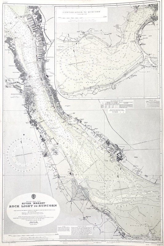
Carta náutica del Almirantazgo Británico / British Admiralty Nautical Chart.
[3477]
La primera edición de este mapa se realizó en 1912, perteneciendo este ejemplar a la edición corregida de 1960.
"From Surveys by the Marine Surveyor to the Mersey Docks and Harbour Board to 1951, with corrections to 1952 [...]" .
"London, Published at the Admiralty, [...] 1912, under Superintendence of Rear Admiral H.E.Purey-Cust, [...] / Crown Copyright Reserved".
|


 Contacto: 91.411.33.62 / info@frame.es")


.jpg "Taller de Enmarcación")