Carta náutica del Almirantazgo Británico // British Admiralty Nautical Chart.
Aus.252
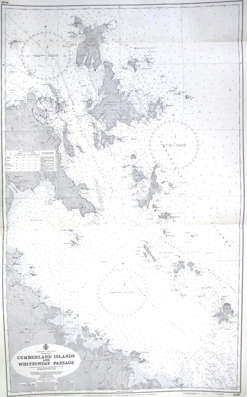
Se representa la zona de los Archipiélagos de Cumberland y Whitsunday, en la Gran Barrera de Coral, frente a la costa de Mackay en Queensland, Australia, y descubiertos por el Capitán James Cook en 1770.
La primera edición de este mapa se realizó en 190?, perteneciendo este ejemplar a la edición corregida de 1966.
"Australia, Published by the Hydrographic Service R.A.N. 9th Nov. 1966, under the Superintendence of Captain D.W.Haslam.".
"Reproduced by the Hydrographer of the Navy, London 1967, by permission".
"From Surveys by the Royal Australian Navy 1925-60 /
and Colonial-Admiralty Surveys to 1885 /
with additions and corrections to 1964" .
Además, incluye correciones a tinta ("Small Corrections"), realizadas durante el uso de esta carta, hasta 1977.
|


 Contacto: 91.411.33.62 / info@frame.es")


.jpg "Taller de Enmarcación")