Carta náutica del Almirantazgo Británico // British Admiralty Nautical Chart.
[1219]
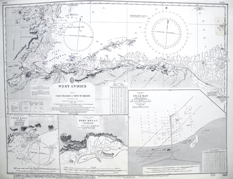
Se representan los territorios de las Indias Occidentales e Islas de Roatán y Honduras en el Mar del Caribe.
"Surveyed by Commanders [...] 1830-39" .
"Surveyed according to Act of Publishment at the hydrographic Office of the Admiralty June 1st 1843 / Crown copyright Reserved".
"New Editions ... 1866 ... 1912 ... 1917 ... 1924..".
Además, incluye correciones a tinta ("Small Corrections") realizadas durante el uso de estas cartas, hasta 1976.
|


 Contacto: 91.411.33.62 / info@frame.es")


.jpg "Taller de Enmarcación")