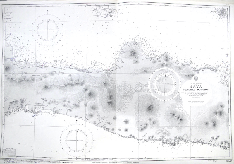
Carta náutica del Almirantazgo Británico // British Admiralty Nautical Chart.
[1653B.]
Se representa el territorio central de la Isla de Java en Indonesia (Sudeste Asiático).
"From the Netherlands Government Charts to 1911 / With Corrections to 1933" .
"London, Published at the Admiralty, 18th January 1934, under Superintendence of Captain J.A. Edgell [...] / Crown Copyright Reserved".
"Engraved 1934"
Además, incluye un gran número correciones a tinta ("Small Corrections") realizadas durante el uso de estas cartas, hasta 1977.
— Australia, Tasmania, New Zealand — |


 Contacto: 91.411.33.62 / info@frame.es")


.jpg "Taller de Enmarcación")